
One of my favourite 1-star reviews of Jane Austen’s Pride & Prejudice was left on Amazon in July of 2010. It reads as follows:
“Just a bunch of people going to each other’s houses.”
Now, can you argue with that, really? It’s a very apt description of the main action and plot devices in our beloved P&P. Even Jane herself makes reference to the movements of her character.
“It must be very agreeable for her to be settled within so easy a distance of her own family and friends.”
“An easy distance, do you call it? It is nearly fifty miles.”
“And what is fifty miles of good road? Little more than half a day’s journey. Yes, I call it a very easy distance.”
“I should never have considered the distance as one of the advantages of the match,” cried Elizabeth. “I should never have said Mrs. Collins was settled near her family.”
“It is a proof of your own attachment to Hertfordshire. Anything beyond the very neighbourhood of Longbourn, I suppose, would appear far.”
So just imagine setting off on a journey across the English countryside to visit with your dearest friend in 1812. No smartphone. No GPS. Not even a detailed map in your pocket. And to make matters worse, you have never actually been to the place you are determined to visit. How is it that anyone got anywhere?
For travellers in Jane Austen’s time and earlier, this was everyday life. In the early 19th century, the art of navigation relied more on intuition, local knowledge, and a patchwork of inconsistent guides of varying degree of trustworthiness.
So how did people find their way across England before standardized maps and modern technology?
The Patchy State of Maps
First, let’s talk about maps, or rather, the lack of reliable ones. Before the Ordnance Survey began producing standardized maps in the early 1800s, most maps of England were general at best and wildly inaccurate at worst. They were often decorative, produced more for estate owners or wealthy collectors than for practical use. By Austen’s time, much of southern England had accurate military and naval maps, developed in order to protect against a French invasion during the Napoleonic wars, but anything significantly north of London was still not standardized.
Road maps existed for the major thoroughfares such as the Great North Road, but they weren’t always helpful for the average traveller. The most famous of these early maps was John Ogilby’s Britannia (1675), which showed strip maps of roads like a modern subway map and highlighted large coaching inns along the way. While revolutionary for its time, it focused on major routes and was often hard to use for detours or local travel.
A more detailed map of the roadways in England was published by John Cary in 1798, the New Itinerary. This map was a practical document that was more like turn-by-turn MapQuest directions than a geographical wall map. There were detailed directions for navigating between hundreds of cities, towns, and moderately sized villages throughout England and Wales. The directions also included fairly accurate distances, mile markers, turnpikes, and couching inns along the route.
It was often bound in leather like a book and small enough to carry in a saddle pouch. Though it would have been most often found in the coaching inn at the innkeeper’s desk, many people who travelled for their main mode of employment, such as stagecoach drivers, postal clerks, and tradesmen transporting goods between rural farms and the major cities, would have considered a relatively updated copy of Cary’s Itinerary essential. If someone like Elizabeth Bennet were traveling to Derbyshire, or Frank Churchill was arranging his journey to London, Cary’s New Itinerary would be their go-to guide for planning the trip, either directly or through someone reading from it at an inn or coaching house.
In short, maps were rare, expensive, and far from user-friendly. Most people didn’t own one, and those who did often couldn’t rely on it in unfamiliar territory.
“I personally believe that U.S. Americans are unable to do so because, um, some people out there in our nation don’t have maps and, uh, I believe that our, uh, education like such as, uh, South Africa and, uh, the Iraq and everywhere like such as, and I believe that they should, uh, our education over here in the U.S. should help the U.S., uh, should help South Africa and should help Iraq and the Asian countries, so we will be able to build up our future.”
-Caitlin Upton, during Miss Teen USA contest in 2007
Verbal Directions and Local Knowledge
In addition to, or completely in the place of maps, most travellers relied on word-of-mouth directions. Asking locals was common, and coaching inns were hubs of geographic knowledge. Think of them as the highway service stations, hotels, post offices, and social media hubs of their day, all rolled into one. An innkeeper could provide a traveller with the most up-to-date information about road conditions in the surrounding 50 miles or so, detours, and even where to find the next inn or blacksmith.
It was best to rely on local knowledge for things like:
- How far to the next post station?
- Will the river be passable this time of year?
- Are there any highwaymen in the area?
Coaching inns were also information hubs. Mail coaches stopped there to swap out mailbags, making inns part of the national postal system. Stagecoach runners used coaching inns as predetermined stops on their routes to change horses (who required swapping out every approximately 10 miles), pick up passengers, and communicate about local hazards.
“I was partaking of my evening meal at the George Hotel, enjoying a fine whisky instead of the usual ale one might drink at a similar establishment in England, when I realized that I had no idea how to get to my next desitnaiton, nor any clue how long it would take to get there. I approached the proprietor (one Mr. Clark), explained my intention to visit Blair Castle, and then could do nothing but blink in wonder and confusion as the rest of the inn’s occupants chimed in with advice.
…
[A]nd this continued for at least ten minutes until finally, old Angus Campbell, eighty years if he was a day, spoke and out of respect everyone quieted down.
‘What he needs to do,’ Angus wheezed, ‘is travel south the Kintyre, turn back north and cross the Firth of Lorne to Mull so that he can be scoot our to Iona, sail up to Skye, cross over to the mainland to Ullapool, back down to Inverness, pay his respects at Culloden, and from there, he can proceed south to Blair Castle, stopping in Grampian if he chooses so he can see how a proper bottle of whisky is made.’
Absolute silence met this pronouncement. Finally sone brave man pointed out, ‘But that’ll take months.’
‘And who’s saying it won’t?’ old Campbell said, with the barest trace of belligerence. ‘The sassenach is here to see Scotland. Are you telling me he can say he’s done that if all he’s done is taken a straight line from here to Perthshire?’ ”
–Romancing Mister Bridgerton, by Julia Quinn
Coaching Networks and Professional Drivers
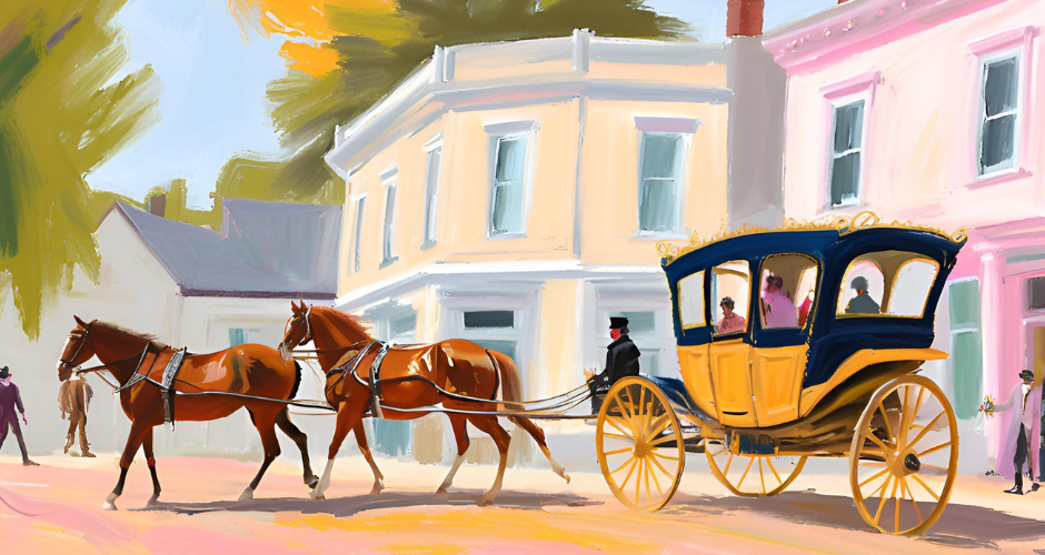
For many travelers, knowing the way was less important than knowing where the closest coaching inn or posting house was situated. Most people in the Regency era would not have had the means for travelling over 10 miles in their own carriage. Travelling in one’s own equipage meant having enough horses for the journey, several servants to drive, and a sturdy enough vehicle to travel on long roads. Only men like Mr. Darcy and Mr. Knightly would have kept a carriage and servants for multi-day personal travel. Most people, even merchants of no small means, would have hired a traveling coach with a professional driver for a journey over 50 miles.
The structure of travel itself often dictated direction and timing of the travel. Most people would have travelled between cities on stagecoaches or on the royal mail coaches, which would often take on paying customers. These public coaches followed fixed routes with scheduled stops at specific coaching inns. These routes functioned almost like a public transportation system. If you needed to get from London to Bath via stagecoach, for instance, you didn’t need a map, you needed to know which coach to take and when it departed.
Similarly, the mail system was tightly organized. Mail coaches travelled at fixed times and speeds, changing horses at regular intervals. For many, simply following the mail coach or using the same route was a reliable way to navigate long distances. While people didn’t typically follow mail coaches in a formal caravan, there were definitely times when private travellers, commercial wagons, or post-chaises ended up intentionally traveling along the same routes as mail coaches. Additionally, travelling with other coaches or following the formal stagecoach routes often provided additional safety on the roads from thieves and highwaymen.
Stagecoach and mail coach drivers were often very well armed.
Conclusion: A Mental Map of the World
Before standardized maps and modern navigation aids, people traveled through a world of mental maps, verbal routes, and community networks. You had to ask, observe, remember, and adapt.
In Austen’s time, movement through space was never just physical. It was intellectual, social, and sometimes emotional. Whether walking a few miles to a neighboring estate or setting out on a cross-country journey, every traveler became part explorer, part networker, and part survivor. So next time you tap your GPS or scroll through Google Maps, remember: for centuries, people found their way by other means. They carried the world in their heads, not their hands, and had to rely on their instincts.
Come Find Me in All the Usual Places


Leave a Reply